OCPP map
See your managed charging sites on a map, filter by availability and operator, and get stations without coordinates onto it.
The OCPP map plots your managed charging sites so you can see the fleet geographically and jump to a station.
Path: /dashboard/maps/ocpp
Sidebar: Charging management → OCPP map
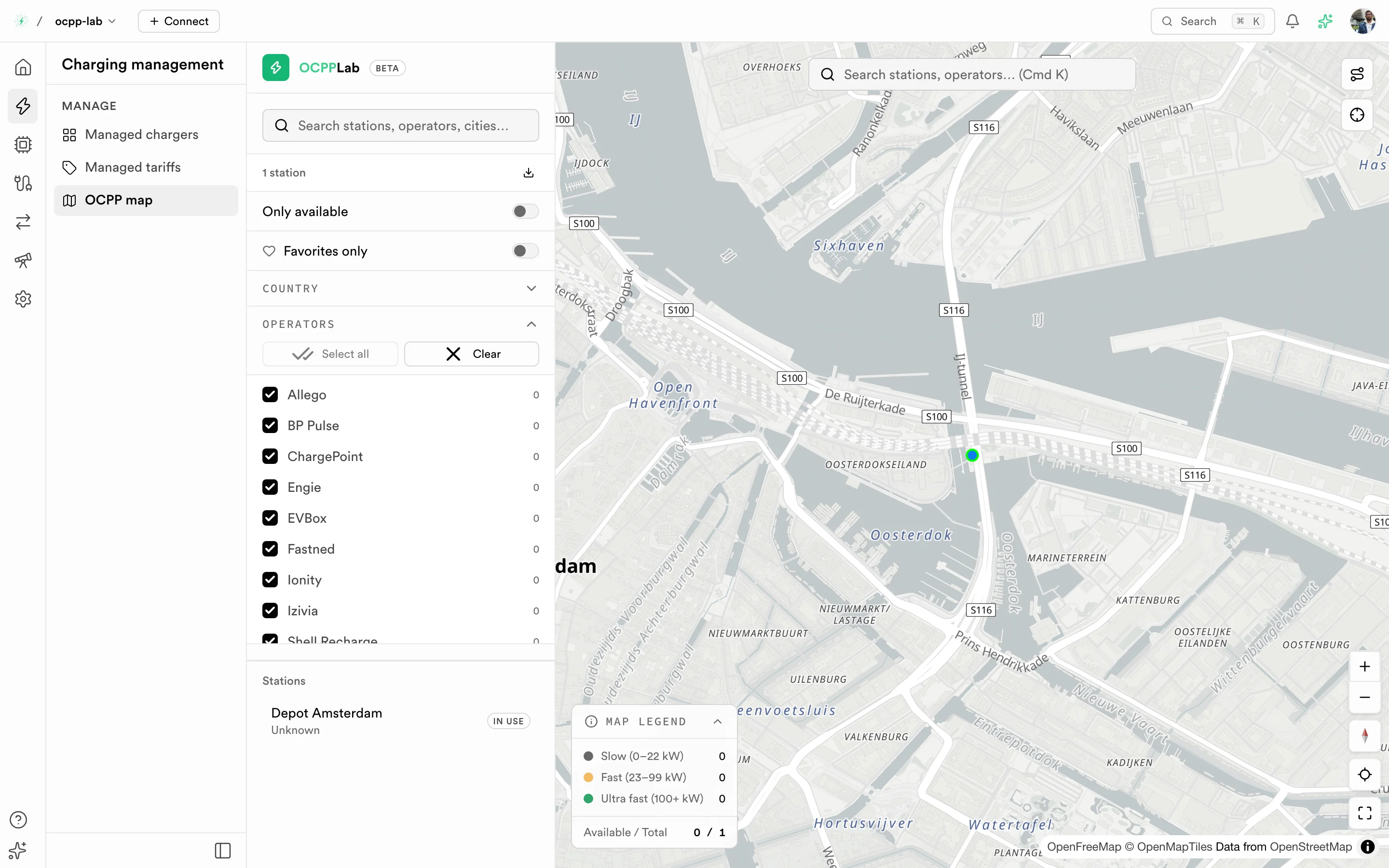
OCPP map. The left panel filters and lists stations; the map shows each site and a legend of charging speeds.
Before you start
A charger appears on the map only when it is assigned to a location that has coordinates. Chargers without a location stay off the map.
What you see
| Element | What it does |
|---|---|
| Search | Find a station, operator, or city |
| Station count | How many stations match the current filters |
| Only available | Show only stations with an available connector |
Favorites only | Show only stations you starred |
| Country and Operators | Narrow by country or operator |
| Stations list | The matching stations with their state |
| Map legend | Charging speed bands and the available-to-total count |
Find a station on the map
- Open OCPP map.
- Search for the station or city, or pan and zoom the map.
- Select a marker or a row in Stations to see its detail.
- Open the charger to check connectors, sessions, or logs on Charger detail.
Put a charger on the map
- Create or edit a site with an address and coordinates. See Charger sites.
- Assign the charger to that site, from Create a charger or the charger's Edit action.
- Reload OCPP map. The station appears at the site position.
Troubleshooting
| Symptom | What to check |
|---|---|
| The map is empty | No charger is assigned to a site with coordinates |
| A station is missing | Clear Only available, Favorites only, and the operator and country filters |
| A station is in the wrong place | Fix the site's coordinates in Charger sites |
For OCPI locations published to roaming partners, use the OCPI map under Roaming.